News · 14 August 2026 · 5 min read
'The bank valued it fine. Then the builder told me I couldn't put a second storey on it — and the house next door already has one'
An investor planned a second storey, then learned his property carried a guideline capping him at single-storey brick veneer. The house next door didn't. The number is assigned per property, not per suburb, and it's free to look up.
A question came in this week from an owner in the Hunter. It is one of the more unsettling ones we get, because nothing had gone wrong yet.
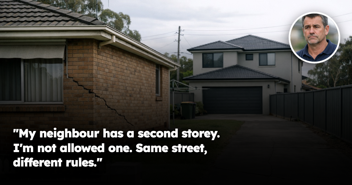
He owns a three-bedroom brick house bought in 2019 as an investment. Years earlier the neighbours added a second storey, and his plan was the same: add up, add value, add rent. He had a builder, a budget and a comfortable bank.
Then the builder came back with one sentence that stopped the project. The property was inside a Mine Subsidence District, and it had been assigned a guideline allowing a single-storey brick veneer or a two-storey lightweight building — nothing else without approval from a state agency he had never heard of.
The house next door sits under a different guideline. That is why it has a second storey and his does not — the same asymmetry as a covenant blocking one subdivision while the neighbour proceeds.
His question was blunt: how can two houses on one street have different build rights, and why did nobody mention it when I bought?
The part most owners have never heard of
In New South Wales, areas where underground coal mining creates a potential subsidence risk to buildings are formally declared as Mine Subsidence Districts. There are 31 of them, and they are not obscure back-country places — they cover Newcastle, Lake Macquarie, Wyong, East Maitland, Lithgow, Appin, Picton and Wilton, among others.
Inside a district, you must get approval from the state subsidence authority before you build, extend or subdivide. That approval sits alongside council — councils must refer the application across. It behaves like an easement quietly removing buildable area.
And here is the mechanic almost nobody knows: every individual property inside a district is assigned a numbered surface development guideline.
Not every suburb. Not every street. Every property.
Why the neighbour got a second storey
The guideline number determines two things, both with money attached.
First, who can approve your build. On some guidelines councils and accredited certifiers approve the work directly. On others the subsidence authority's approval is mandatory. Same council, same street, different pathway.
Second, what you are permitted to build. The most restrictive guideline applies to land assessed as carrying sinkhole risk — where historic shallow workings could collapse and open a hole at the surface. There, residential development is limited to a single-storey brick veneer or a two-storey lightweight structure. The alternative is an engineer-designed structure capable of accommodating a pothole up to five metres in diameter forming at any point beneath it.
Read that again. The design standard is not "the ground might move a bit." It is "assume a five-metre hole could open anywhere under this house."
Where a proposal exceeds its guideline it goes to merit assessment, and applicants may have to fund geotechnical studies and borehole investigations — seven days for a compliant application, forty for a merit one.
Why this is a street-level question, not a suburb one
This is the clearest example we have seen of something we argue constantly: the boundary that decides your outcome runs through suburbs, not around them.
Two houses can share a postcode, a median, a council, a catchment and a station, and sit under different guidelines — because what is assessed is what lies under that particular parcel of land. Historic workings around the Hunter and Newcastle were often shallow and irregular, some extracted more than 150 years ago. When they fail, the subsidence is generally localised, typically affecting a single property. That is not marketing language — it is how the regulator describes the risk.
A second point cuts both ways. A house directly above collapsed workings can subside without damage if the whole building settles evenly — while a house never undermined can be damaged, sitting on the edge of a subsidence trough where the ground tilts and strains. Position and consequence are not the same thing.
Which is why a suburb-level number cannot answer this. A median averages properties with unrestricted build rights and ones capped at single storey, and describes neither. It is the same dispersion we measure everywhere else — the same reason a bushfire attack level can differ wildly between neighbours: two streets inside one suburb routinely differ 20–30% on effective yield on achieved rents, real vacancy duration and actual days on market. Here, the driver of that dispersion is written down, numbered, and free to look up.
The compensation trap nobody checks
If your property is damaged by mine subsidence, you may claim compensation — from the responsible mine operator in active mining areas, and from a levy-funded state fund elsewhere.
But eligibility carries a condition, and it is the most expensive detail in this subject: buildings are eligible provided the correct development approvals were obtained. Not obtained by you. Obtained — full stop.
If a previous owner added a deck, carport or second storey inside a district without subsidence approval, that structure may sit outside the compensation scheme. The legislation gives the authority discretion to pay where the failure was not the current owner's fault — but discretion is not entitlement, and it is a poor thing to rely on with a cracked wall.
The corresponding protection is under-used: buyers may withdraw from a contract of sale where a structure does not comply. That right only matters if you check before you exchange.
So: search the address on the state planning portal's spatial viewer, which returns whether the property is in a district, which guideline applies, and whether mining occurred nearby. Have your conveyancer confirm in writing that every structure holds the correct approvals. And ask whether a claim has been lodged — there is no public register, so if you do not ask, you will not be told.
So should he have avoided it?
No — and the regulator's own position is the most useful thing here. It notes many areas of the state where underground mining is well known still see high demand for property, pointing to Newcastle as a market that has managed subsidence risk for generations while remaining vibrant.
That is the honest read. This is not a hazard that destroys markets. It is a constraint priced unevenly, because it is assessed per property while the market prices per suburb. The cost lands almost entirely on the owner who assumed a development upside the land does not carry.
Our Hunter owner has not lost money. He lost a plan he never verified. His block still produces rent in a market with genuine demand. What he cannot do is the one thing he bought it to do — and he could have known that in four minutes, for free, before he made an offer.
The buyers who do well here are not the ones who avoid the districts. They are the ones who look up the guideline first and pay accordingly — a capped block bought at a capped price is a perfectly good asset; a capped block bought at a development price is an expensive mistake.
He researched the suburb. The state had already published the answer for his address. Nobody looks.
If there's a specific street you're weighing up right now, check its Street Score first — it's free, takes ten seconds, and tells you whether that street is pulling the suburb average up or riding on it.
Market data & R-Scores for locations in this article
Drill Down Into the Markets Mentioned Above
Inspect live monthly R-Scores, median prices, rental yields, and street-by-street scores for the cities and council areas referenced in this article:
Frequently asked questions
Why can one house in the same street be allowed to add a second storey while the neighbour cannot?
In a NSW Mine Subsidence District, the rule is assigned to each individual property, not the suburb or street. That means two neighbouring homes can sit under different surface development guidelines and have different build rights.
What is a Mine Subsidence District in New South Wales?
It is an area where underground coal mining has created a potential risk of ground subsidence affecting buildings. The article says there are 31 such districts in NSW, including places like Newcastle, Lake Macquarie and Wyong.
What can you build on land with the most restrictive mine subsidence guideline?
The article says the most restrictive guideline limits residential development to a single-storey brick veneer or a two-storey lightweight building. Anything beyond that may need approval from the state subsidence authority.
Do you need approval from the state subsidence authority before building in a Mine Subsidence District?
Yes, in a Mine Subsidence District you must get approval before you build, extend or subdivide. Councils must refer the application, and on some guidelines the authority’s approval is mandatory.
What is the main risk if a previous owner added work without the right subsidence approval?
The article says that damaged buildings are only eligible for compensation if the correct development approvals were obtained. If a previous owner built without subsidence approval, that structure may sit outside the compensation scheme.
General information only. It does not take your objectives, financial situation or needs into account, and nothing here is legal, financial, taxation or investment advice specific to your circumstances.